
Kansas & Missouri · Olathe based
Construction progress
drone photography.
Keep your project team informed with consistent aerial views of your site. RDR Aerial Technologies, LLC provides construction progress imagery across Kansas and Missouri, including the Greater Kansas City area.
Request a construction quote →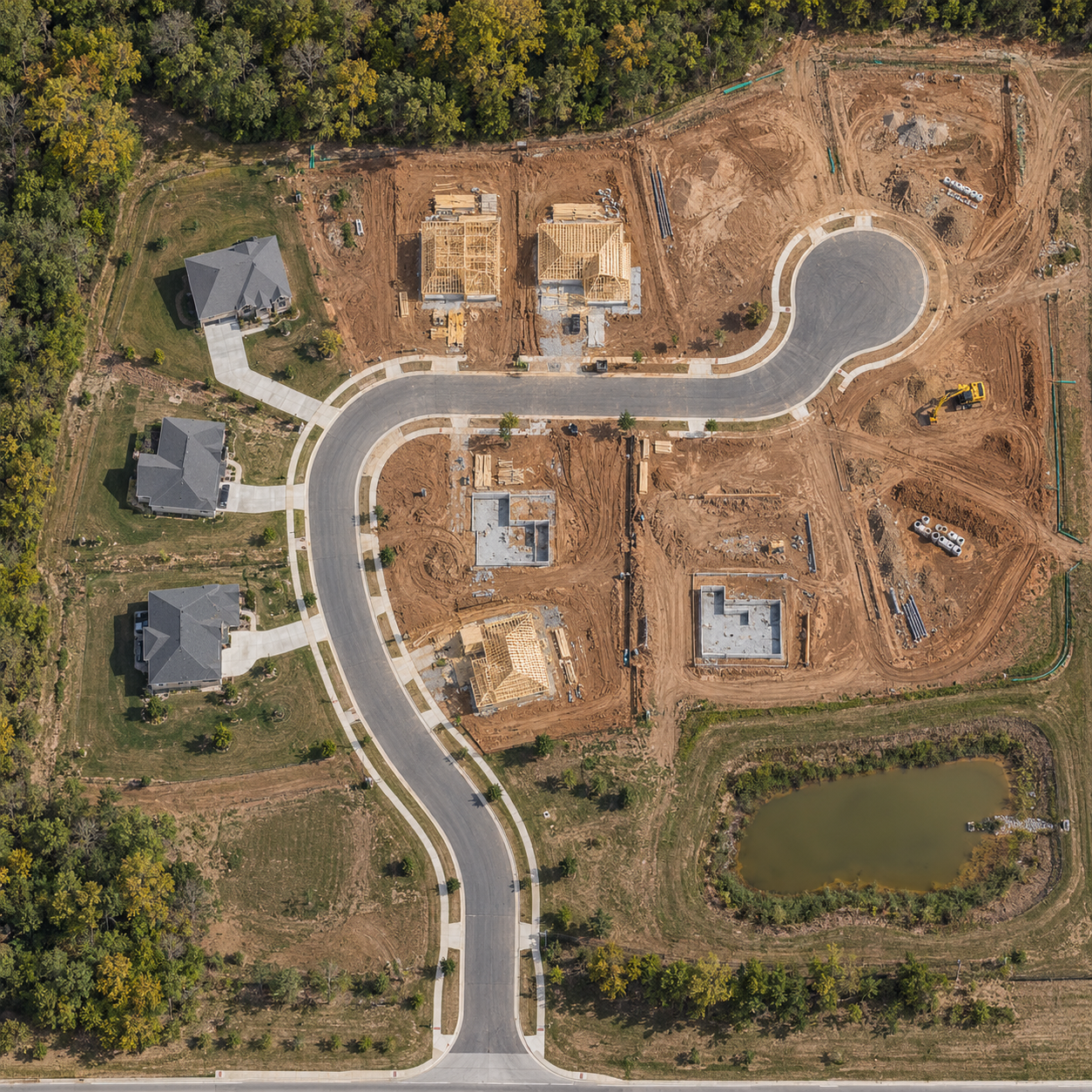
A useful record from above
See what changed.
Share where work stands.
Consistent viewpoints
Agree on aerial views that show the areas your team needs to follow. Repeat those perspectives across scheduled visits to make visible changes easier to discuss.
Clear stakeholder updates
Use current site imagery in project meetings, owner updates, and presentations. Give remote team members context for access, work areas, and visible activity.
Organized delivery
Receive an image set organized by capture visit, with viewpoints and delivery arrangements defined in your scope. Keep a visual record as the site evolves.
Visit plans
Capture at milestones.
Or keep a regular rhythm.
Choose a one-time visit or a recurring schedule for one standard site up to 10 acres. Flight dates are coordinated around access, airspace, and suitable weather.
ONE VISIT
$325 per visit
A standalone image set for a milestone, current site overview, or project discussion.
TWO VISITS
$600 per month
Two coordinated capture visits to maintain a regular visual record.
FOUR VISITS
$1,100 per month
Four coordinated capture visits for a more frequent progress record.
These plans include construction photo documentation, consistent aerial viewpoints, and organized image delivery. Orthomosaic processing, 3D models, and comparison reports are separate. A comparison report is a $150 add-on when agreed in scope. Larger sites, travel, additional outputs, and applicable fees are confirmed in your itemized estimate.
Choose the right output
Photos, maps,
or a 3D view?
Progress photos are a visual record of a visit. A 2D orthomosaic stitches overlapping images into an overhead map. A textured 3D model shows shape and spatial relationships from angled views. These are different deliverables with different capture and processing needs.
If your team needs a map or model alongside repeat photography, tell us how you intend to use it. We will scope coverage and formats before capture. Visual imagery does not replace a licensed survey, engineering review, safety assessment, or required inspection.
Compare all drone services →Before your first visit
Common project questions
What information should I send for a quote?
Include the site location, approximate acreage, preferred deadline, intended use, and any recurring visit requirements. Identify the areas or viewpoints that matter to your team and tell us who will receive the imagery.
Can you follow the same viewpoints on later visits?
We plan recurring viewpoints around the agreed scope and site conditions. Site access, airspace, weather, and changes on the ground can affect flight plans, so each visit is coordinated with your site contact.
Can the photos replace an on-site inspection?
No. Aerial imagery documents visible conditions and supports communication. Your qualified project team still performs any required inspections and verifies issues before making decisions.
Which areas do you serve?
Based in Olathe, Kansas, we serve projects across Kansas and Missouri. Share the location when requesting a quote so we can confirm scheduling and any travel charges.
Start with your site
Make the next update
easier to see.
Tell us where the project is and what your team needs to document.
Request a project quote →