
2D drone mapping / Kansas & Missouri
2D orthomosaic
drone mapping.
2D orthomosaic drone mapping brings overlapping aerial images together into a detailed overhead view. Give your team a shared visual reference for planning, site discussions, and progress documentation.
Get an orthomosaic quote →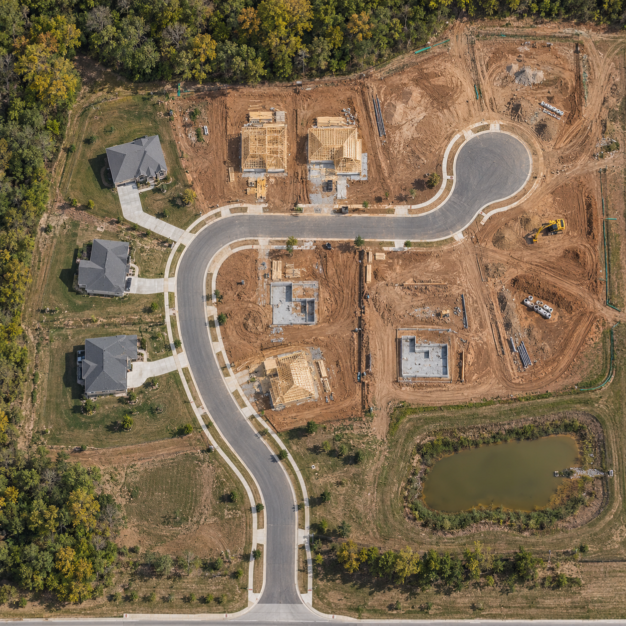
See the whole site together
More context.
Fewer disconnected photos.
Construction coordination
Discuss visible work areas, site access, staging, and changing conditions using one overhead reference.
Land & property context
Show the relationship between visible buildings, roads, open areas, and surrounding features for project conversations.
Repeat site records
Capture agreed milestones or recurring updates. Keep dated overhead imagery to help your team review visible change.
What you receive
A useful map starts
with a defined scope.
Your quote defines the capture area, processing, delivery format, and how your team intends to use the imagery. Standard scope includes planned aerial capture, a processed 2D orthomosaic, and agreed digital access or export.
Tell us which software your team uses before booking. File formats, image resolution, coordinate requirements, and any measurement needs are confirmed for the project.
For measurements, design, or regulated work, accuracy and control requirements must be assessed before capture. A visual orthomosaic does not establish legal boundaries or replace a certified survey.
Straightforward starting rate
2D orthomosaic mapping
from $700.
One standard site up to 10 acres: $400 aerial capture + $300 2D processing. Includes planned capture, orthomosaic processing, and agreed digital delivery.
Additional coverage is $150 per extra 10 acres or part thereof; extra processing may apply. Travel, specialized outputs, rush requests, and applicable fees are confirmed in an itemized estimate.
Define your mapping scope →Common questions
Before we map your site.
How is an orthomosaic different from one aerial photo?
An orthomosaic combines many overlapping images into a processed overhead map. A single aerial photo captures one viewpoint and can show stronger perspective distortion. The capture and processing plan determines the final mapping output.
Can I measure distances or areas?
Measurement suitability depends on capture design, positioning, ground control, processing, and validation. Tell us your required tolerance and intended use before booking so we can assess the scope. We do not promise survey accuracy from a standard visual mapping package.
Can you add a 3D model?
Yes. Defined-area 3D capture and processing can be scoped alongside 2D mapping. Explore 3D site models and package pricing.
Can I schedule recurring maps?
Yes. We can quote repeat orthomosaic captures around your milestones or visit schedule. Construction progress photo plans are also available; map processing is priced separately.
Kansas & Missouri
Local planning.
Coverage to fit your site.
RDR Aerial Technologies, LLC is based in Olathe, Kansas and serves projects across Kansas and Missouri. Send the site location, acreage, intended use, and preferred deadline. We confirm access, airspace, suitable weather, scheduling, and any travel costs before booking.
Request a mapping quote →