
3D drone mapping / Kansas & Missouri
3D drone mapping.
A fuller site view.
3D drone mapping turns overlapping aerial imagery into a textured site model. Bring buildings, terrain, and visible site features into one spatial view for project discussions and presentations.
Get a 3D mapping quote →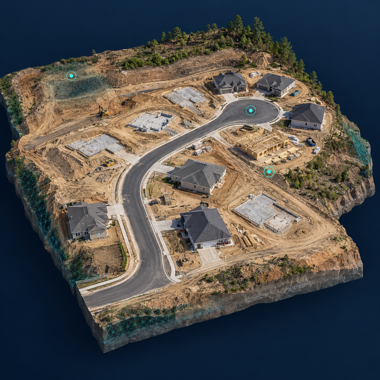
Put shape into the conversation
Spatial context
your team can share.
Site coordination
Explore visible relationships between structures, roads, and terrain. Give remote stakeholders a clearer sense of the site.
Building visualization
Use textured exterior views to support presentations and discussions about an agreed building or defined site area.
Project communication
Present a site in context and explain visible conditions. Pair the model with overhead mapping or progress imagery when useful.
Choose the right view
2D shows the layout.
3D adds the shape.
A 2D orthomosaic gives you an overhead image map. A textured 3D mesh adds visible surfaces and depth from multiple image angles. Tell us what your audience needs to understand so we can recommend a useful combination.
Your scope defines coverage, angled image capture, processing, and agreed viewing access or export. Software compatibility and output formats are confirmed before capture.
Quantities, elevations, and other measurements require a separate assessment of accuracy, control, and validation. A visual 3D model does not replace a licensed survey or engineering review.
2D + defined-area 3D
Mapping and a 3D model
from $1,225.
Includes standard 2D mapping up to 10 acres ($700), plus angled imagery ($175) and 3D processing ($350) for an agreed building or smaller defined area.
Full-site 3D coverage is quoted separately. Complex structures, expanded coverage, specialized outputs, travel, rush requests, and applicable fees are confirmed in your itemized estimate.
Scope your 3D model →Common questions
Plan the model around its purpose.
Is the example an actual customer project?
The subdivision shown here is a concept illustration. It demonstrates the type of site context a model can communicate. Deliverables for your project use imagery captured at your actual site.
Does the starting price include my whole site in 3D?
No. The starting package combines standard 2D mapping up to 10 acres with 3D coverage of an agreed building or smaller defined area. Full-site 3D requires its own capture and processing scope.
Will the model show hidden or interior features?
Aerial photogrammetry reconstructs surfaces visible in the captured imagery. Obstructions, vegetation, reflective surfaces, and poor visibility can leave gaps or reduce detail. It does not reveal underground services or hidden interiors.
Can a model help with stockpile quantities or elevations?
Stockpile volume services are not currently offered. Elevation or other measurement needs require a separate assessment of capture, control, and validation. The standard visual model package does not include certified quantities, engineering outputs, or a guaranteed measurement tolerance.
Kansas & Missouri
Local planning.
Coverage to fit your site.
RDR Aerial Technologies, LLC is based in Olathe, Kansas and serves projects across Kansas and Missouri. Send the site location, acreage, intended use, and preferred deadline. We confirm access, airspace, suitable weather, scheduling, and any travel costs before booking.
Request a mapping quote →